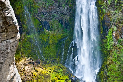
The Rogue River flows, strong and clear, past the Gorge and into the Natural Bridge area.
There is a lava tube there, into which the Rogue River drops. The river all but disappears under the ground, flowing through several lava tubes.
It finally emerges with great force many yards downstream.
Not all the tubes flow clearly. This one is blocked and the water enters, circulates and exits at the same portal.
Tuesday, May 18, 2010
Sunday, May 16, 2010
Two Waterfalls
The Rogue drops into a boulder field near Mill Creek.
Below the field, the Rogue becomes a very intricate Class 5 whitewater run bracketed on each side by vertical walls about 150 feet high. Dropping into this canyon below the boulder field are two waterfalls, Barr Creek Falls and Mill Creek Falls.
Barr Creek Falls...
Mill Creek Falls...
Below the field, the Rogue becomes a very intricate Class 5 whitewater run bracketed on each side by vertical walls about 150 feet high. Dropping into this canyon below the boulder field are two waterfalls, Barr Creek Falls and Mill Creek Falls.
Barr Creek Falls...
Mill Creek Falls...
Friday, May 14, 2010
Crater Lake
Crater Lake is formed from the collapsed caldera of Mt Mazama. The resulting lake is over 1000 feet deep and is fed only by rain and snow runoff from the caldera sides. It is considered to be the cleanest, purest lake in the world. Right now, in mid-March, the snow there is about 10 feet deep in places. The blue of the lake has to be seen to be believed.
The outer slopes of the remnants of Mount Mazama feed the headwaters of a number of rivers, among them the Rogue. About 30 miles from the caldera the Rogue drops into a collapsed lava tube. The entire river is compressed into a channel that is so narrow that one could almost step across it. The force of the river pushing through this slot is incredible.
To the southwest rises another, much smaller volcano, Mount McLoughlin. Its symmetry and snow-capped peak are truly beautiful.
Sunday, May 9, 2010
3 Waterfalls on the McKenzie
The McKenzie River flows out of the Cascades to Eugene, where it joins the Willamette River. It is paralleled by Route 126 which provides some stunning views of the mountains ahead.
The upper McKenzie drops over three lava flows from Belknap Crater, two from 3000 years ago and one from 1500 years ago. The result is a beautiful and clean river and three waterfalls, Sahalie Falls, Koosah Falls and Tamolitch Falls.
The upper or first is Sahalie Falls. It drops 120 feet in two parallel cascades.
The middle drop is Koosah Falls. This one drops 90 feet in a series of steps and slopes. It was beyond my safety zone to get a good angle to photograph it. (Oops - I learned from a comment that this is not Koosah, but is simply a small cascade.)
The third waterfall is Tamolitch. (Oops - this is actually Koosah. Tamolitch would have been well beyond my hiking range. Thank you, commenter, for the help.)
Between these drops, the McKenzie River romps playfully, clear and cold.
It is May 8th, and many of the roads up there are still closed by snow. I actually ran into a snow flurry there. As Yakoff Smirnoff says, "Whadda Country!"
The upper McKenzie drops over three lava flows from Belknap Crater, two from 3000 years ago and one from 1500 years ago. The result is a beautiful and clean river and three waterfalls, Sahalie Falls, Koosah Falls and Tamolitch Falls.
The upper or first is Sahalie Falls. It drops 120 feet in two parallel cascades.
The middle drop is Koosah Falls. This one drops 90 feet in a series of steps and slopes. It was beyond my safety zone to get a good angle to photograph it. (Oops - I learned from a comment that this is not Koosah, but is simply a small cascade.)
The third waterfall is Tamolitch. (Oops - this is actually Koosah. Tamolitch would have been well beyond my hiking range. Thank you, commenter, for the help.)
Between these drops, the McKenzie River romps playfully, clear and cold.
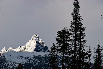
At my campsite when I started out, the day was clear, sunny and about 80 degrees. Above the falls area, in the headwaters of the McKenzie is a mountain named 3 Fingers Jack.
It is May 8th, and many of the roads up there are still closed by snow. I actually ran into a snow flurry there. As Yakoff Smirnoff says, "Whadda Country!"
Subscribe to:
Comments (Atom)


