In northern New Mexico is a little town called Questa. A few miles to the west is an area called Wild Rivers at the junction of the Red River and the Rio Grande. This is what Google Earth says it looks like.
(The red arrow shows the start of one of the trails you will see later.)
This is what it looks like from the ground.
(Yep, that's my toes at the edge)
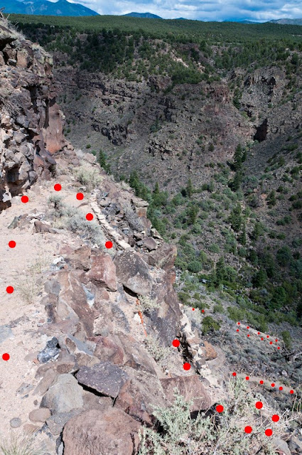
In general, the top area is high desert plateau. The two rivers form steep-sided canyons. Trails have been built leading down those canyon sides. Looking down from above, the trails form a series of switchbacks. I marked them with red to make them easier to see.More often, the only protection is your balance.
The steepest points have steps to help a bit.
But the operative instruction is "Watch your step!"
And what goes down, must come up... 800' from the bottom to the top. More than once, I gave water away to hikers who had not planned well.
The campsites were nice. Most were set right at the edge of the canyon, affording beautiful vistas, and New Mexico skies are often rewarding. The obvious view was toward the setting sun,
but looking the other way could also be impressive.
On three nights during my stay, thunderstorms rolled through, within 20 miles or less. The second night, lightning was concentrated about 8 miles to the south, where I had a good view of the sky from my site.
What a great way to end the day.


